
Meadow / Gauley (WV)
Length: 40 miles
Permitted: No
Days: 2
Class: V
Craft: kayak, canoe, inflatable
Season: late fall-early spring; rainfall year-round
Gauge: Meadow @ Nallen, Gauley @ Summersville
Map: click here
The Meadow River and the Gauley are both ultra-classic runs with a long history of river-running, but most people don’t think to do a multi-day trip linking up 40 miles of whitewater.
Requirements
It’s West by-god Virginia, no one cares what you do. As always, use a groover or dig deep cat-holes away from water sources and leave your camp as you found it (or cleaner).
Shuttle & Logistics
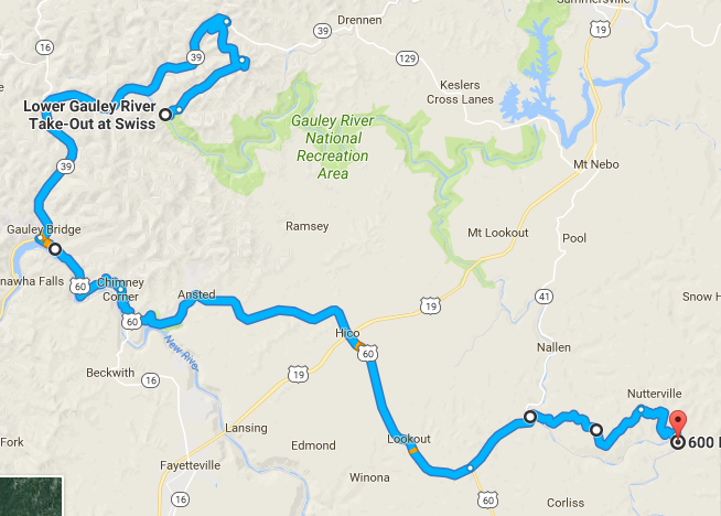
The logistics for the Meadow/Gauley overnighter are fairly straightforward. Drop a car in the town of Swiss at the takeout for the Lower Gauley. Take highway 60 through Hico to Russellville. A West Virginia Gazetteer or (better yet) a local paddler will come in handy. The roads from Russellville to the put in for the Upper Meadow are poorly maintained, vague and hard to follow due to constant logging in the area. If all else fails, an alternate put in is available and easy to find in Charmco, WV, at the intersection of highways 20 and 60. This put in adds on 10-12 miles of flatwater. Four wheel drive with clearance is recommended for the put in at Burdette. The total drive from Swiss to Burdette is one hour if the road is in good condition.
Raft guides frequent the area during the rafting season and might be available to run shuttle for the right price. It would be worth more than a few dollars to avoid retrieving the put in car at the end of a long weekend of paddling.
Flows
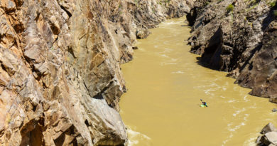
Water levels are easy to gauge from the Meadow @ Nallen and Gauley below Summersville readings. 900cfs on the Meadow at Nallen is the minimum flow for an enjoyable experience on the Upper. The Middle and Lower Meadow require 680cfs. Expect big water and bigger fun on the Gauley when the Meadow is fluid. On our winter trip we had 1350cfs on the Meadow at Nallen and the Gauley was running 8000cfs (5700 out of Summersville dam plus the flow on the Meadow).
On the Water
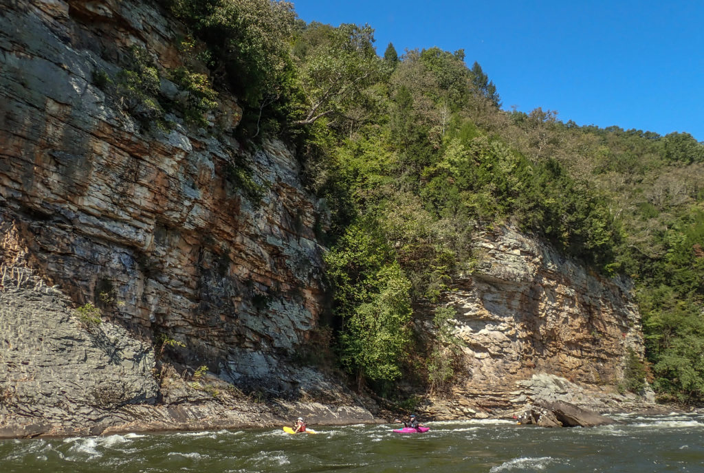
The entire 40 mile trip has been done by ambitious groups in one long day, but it is a legitimate one night, two day adventure. The Upper Meadow is full of high quality, continuous class III and IV. It has a creeky feel, similar to the Watauga in North Carolina. Several miles of fast moving flat water separate the Upper and Middle Meadow. The Middle develops a bigger river feel, and features the giant breadloaf rocks that West Virginia is known for. The whitewater on the Upper and Middle is boat scoutable by the class V boater, which you will definitely want to be once you float under the highway 19 bridge. This is the put in for the infamous Lower Meadow.
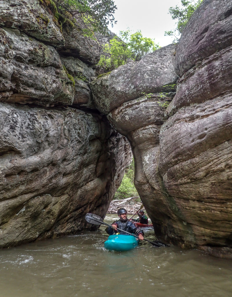
The first half mile of the Lower Meadow is dark, intense and dangerous. The first set of rapids-Rites of Passage, Hell’s Gates, Brink of Disaster and Coming Home Sweet Jesus make this trip a true class V-V+ overnighter.
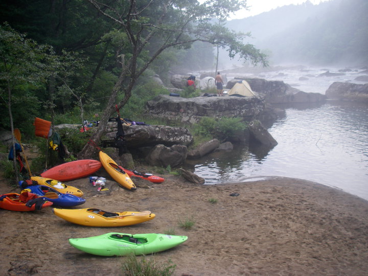
Plan on six to eight hours to get below the last big drop on the Lower, Double Undercut. Winter trippers will be grateful for the ample bony driftwood piled up on sandy beaches near the confluence of the Meadow and Gauley.
If sunrise finds a motivated crew there is an option to hike unloaded boats three miles up an old railroad grade on river left to the top of Brink of Disaster. If your adrenal glands are depleted just load up and head downstream into 20 miles of big water on the Gauley. Groups that are competent running the Lower Meadow at high water will find the Gauley routable down the middle.
If shuttle was arranged all that is left to do is stop in Fayetteville for Pies N Pints for a celebratory beer. The pizza is delicious and they have the best wings south of Buffalo.
Video
40 Mile Day from Stewart Caldwell on Vimeo.
This article was contributed to CampingByKayak.com by Adam Herzog, with special thanks to Stewart Caldwell. Photos contributed by Bill Blauvelt and Jeff Macklin.