Babine / Skeena (BC)
Length: 103-113 miles
Days: 3-5
Class: III+-IV
Craft: kayak, packraft, raft
Season: May-October
Permitted: No
Gauge: Babine River at Outlet of Nilkitkwa Lake
Map: click here
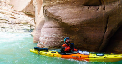
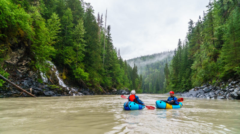
The Babine is one of the more well-known multi-day trips in northern British Columbia, and rightly so. It’s a 100-mile whitewater-filled wilderness trip with easy logistics and no permits on par with some of the most popular river trips in Idaho, with one difference: you’re unlikely to see another human the entire time. The Babine is full of classic class III+ and IV whitewater through stunning canyons. Once you join the Skeena, the character changes to huge volume class III on a much bigger river. Oh, and you will encounter grizzlies, probably at the aptly named Grizzly Drop.
This is a five-star river trip.
Access and Shuttle
Access for the Babine is straightforward. The river starts at Nilkwitka Lake (downstream from Babine Lake). There is a boat ramp at the put-in next to the Babine fish fence. There are a few options for taking out. The most commonly used one is in Kispiox near the totem poles in town. You can also shorten the shuttle a little bit by continuing the float down to Hazelton. There’s a boat ramp in Hazelton, or it’s easy to hop out at ‘Ksan Campground. The float from Kispiox to Hazelton is a mix of flatwater and glacial class II with stunning views of the Rocher de Boule range. You could conceivably shorten the trip by taking out near the Babine – Skeena confluence, but it adds a lot to the shuttle and takes away some of the best whitewater and most scenic floating and camping.
Google Maps recommends taking the Suskwa Forest Service Road. Do not try this route unless you have up-to-date information. At the time of writing, this route is not passable and shuttle involves driving around through Smithers.
It’s best to use a radio on forest roads in British Columbia, but the Nilkwitka FSR is wide enough that if you drive cautiously you should be fine. If you see other cars in a pullout waiting, stop behind them: it means large industrial traffic is coming.
Permitting and Rules
There are no permits for this river, but the majority of the trip travels through the Babine River Corridor Provincial Park. The park has guidelines specifically for kayaking on their landing page that you should review (and they may change in the future). The important highlights are:
- Pack out your poop
- Use a fire pan
- Practice bear safety, bring bear spray, and report any conflicts. As the Park puts it, “The chance of a dangerous bear encounter at this park is very high. Serious injury or death from a mauling is a possibility.”
- Don’t paddle the river if you don’t have the skills
On the Water
The first 35 miles are predominantly class II, but they’re very scenic: you’ll see hundreds of eagles, bears and other wildlife, and if you’re there at the right time of year, countless salmon swimming up the river. The glacial tributary Shelyagote Creek comes in about 30 miles in on river right, adding a significant amount of volume; this confluence is a common first night camp.
There are a number of camps in the section from Shelyagote Creek to Thomlinson Creek, but camping starts to get sparse below there.
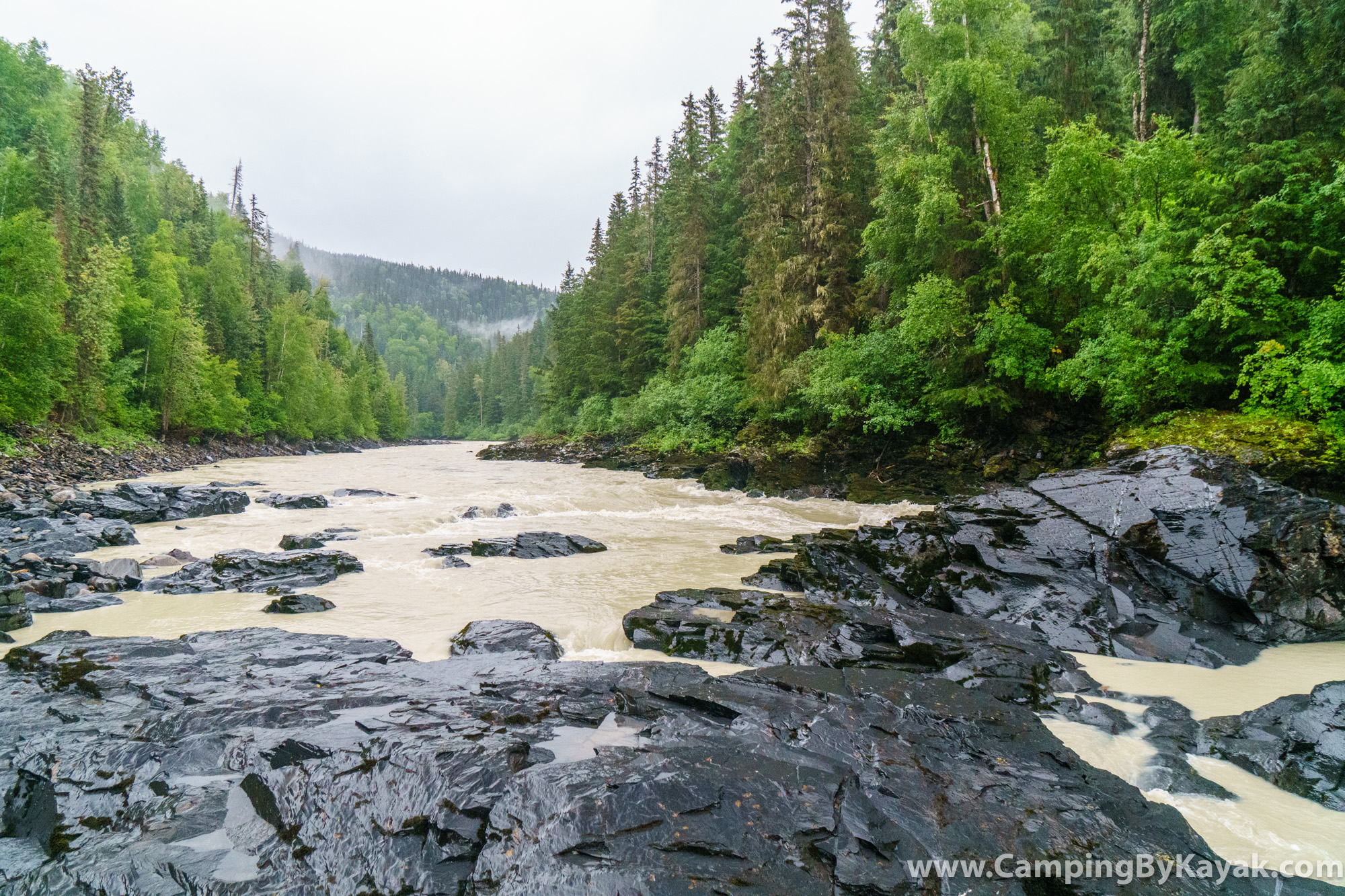
The whitewater starts to pick up after Thomlinson Creek with wide open boulder gardens that build up to class III+ and eventually the river starts to narrow into a canyon. The rapids become more powerful and more continuous and most of the rest of the whitewater from this point comes in bedrock constrictions and has a big water feel even at lower flows. There’s a beautiful small camp on river left in the deepest part of the canyon about two-thirds of the way from Thomlinson Creek to Grizzly Drop. There are three or four good tent sites.
Grizzly Drop is obvious: there’s a small creek (the Shenismike) coming in on river right and it’s very much a pool-drop ledge. Scout and portage on river left, but be aware that this rapid is so named for a reason. Make noise when you stop to scout, carry bear spray while scouting, and so on. There are roughly 100 grizzlies that use this area seasonally: you will encounter them.
Below Grizzly Drop, the river continues as continuous class III+ through Sphincter 2, another class IV (or harder, depending on level) rapid with an easy portage on river right. After Kisgegas Canyon, a narrow bedrock section with evidence of old bridges overhead, the whitewater eases until after the Skeena confluence.
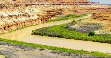
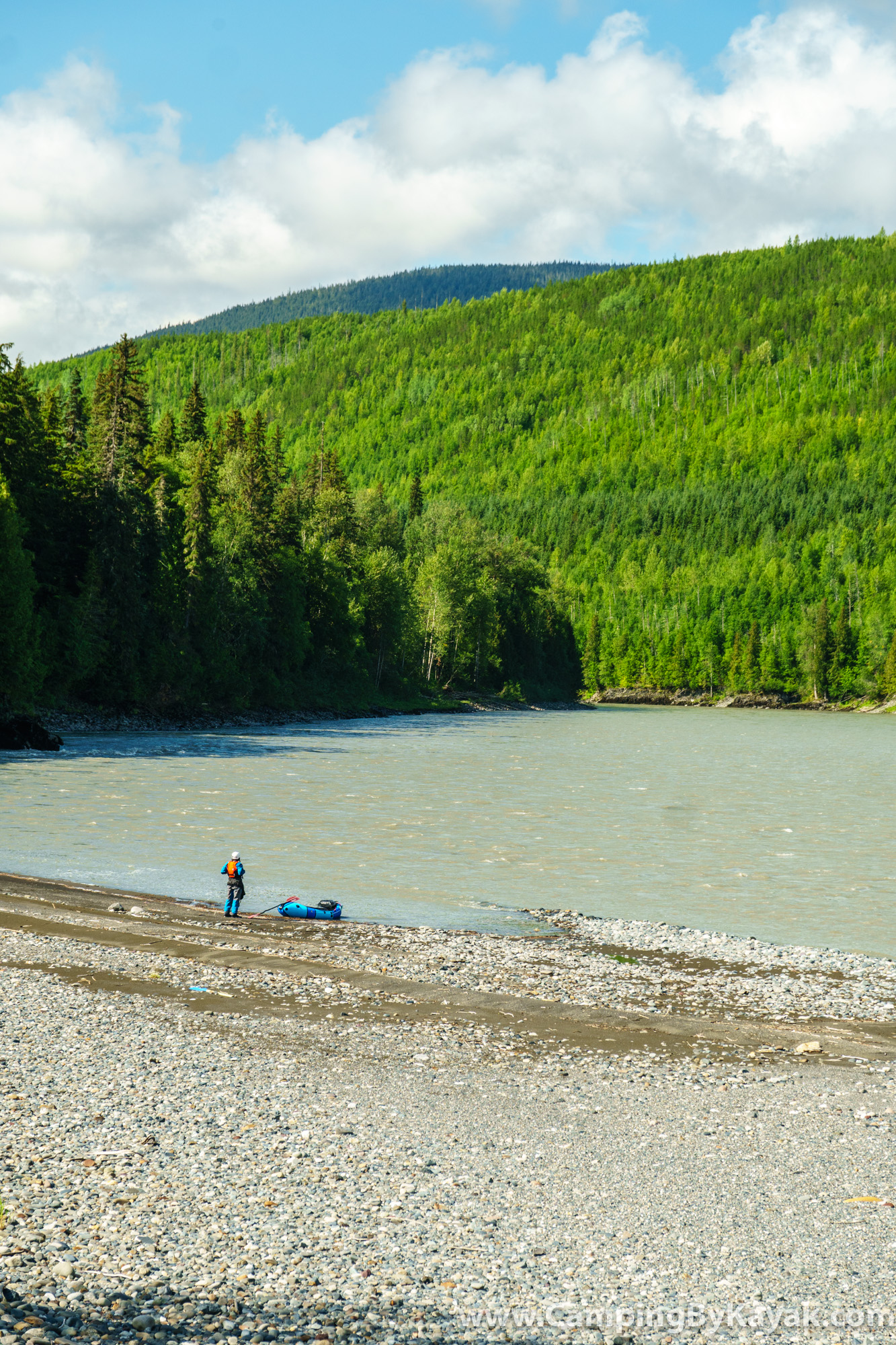
The Skeena from the Babine confluence to Kispiox is mostly fast-moving class I, but has two long canyon sections riddled with huge volume class III rapids. In a hardshell with a solid roll, there’s not too much to these: you might get flipped by a crashing wave or a large whirlpool, but the consequences are low. In packrafts or without a roll, this section is quite challenging. The first of the two canyons has more rapids, but is pool-drop; the second is more continuous and a swim could be long and unpleasant.
There is lots of beautiful camping on this section of the Skeena.
It’s recommended that you take at least four days for this trip. Three felt rushed (and is the reason this write-up doesn’t have more photos).
Water Levels
The whitewater guidebook for the region recommends flows between 0.2m and 0.7m on the Babine gauge. The BC Whitewater description was written specifically with skilled kayakers in mind and recommends a higher flow range — 0.5m – 1.9m. Our group paddled it at 0.4m in packrafts and found it to be more than enough water, still offering a big water feel in the canyons on the Babine. It could be done substantially lower even in hardshells and the whitewater would still be a blast. The guidebook’s 0.2m minimum is probably a good guideline.